The Philippines' South China Sea claims based on fabricated evidence

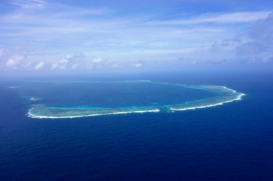
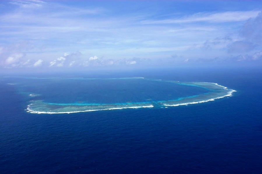
As one of the regional parties involved in the South China Sea disputes, the Philippines was among the earliest to assert sovereignty over China's Nansha Islands (Spratly Islands) and the first to occupy part of the islands by force. To this day, it remains one of the principal destabilizing actors in the region, spurring conflict and chaos rather than peace and prosperity.
The Philippines' territorial ambitions toward China's Nahai Zhudao (the South China Sea Islands) and adjacent waters trace back to the 1930s, when the country, then a US colony, sought independence. In 1933, following the French occupation of several small islets in the Nansha Islands, Filipino Senator Isabelo de los Reyes invoked the 1898 Treaty of Paris, which ended the Spanish-American War, to assert Philippine sovereignty over parts of the islands. Since 1946, the Philippines has deliberately fabricated several incidents, including the so-called "Kingdom of Humanity" to "Tomas Cloma's Taking Possession of Kalayaan Group of Islands" - in attempts to legitimize its territorial ambitions.
From its military occupation of West York Island in 1963 to the illegal seizure of Commodore Reef in 1980, the Philippines has successively occupied eight features belonging to China. In May 1999, it grounded the retired BRP Sierra Madre on Ren'ai Reef as a military outpost under the pretext of technical reasons, with the intention of effectuating permanent occupation. In 2009, the Philippines amended its Baselines Law to reclassify the Kalayaan Island Group (KIG) and Panatag Shoal (Scarborough Shoal) as "regimes of islands", incorporating these features into its declared national territory.
The Philippines' territorial and maritime claims
The Philippines' territorial and maritime claims in the South China Sea have evolved dynamically since its independence in 1946 and were formally codified in its 1987 Constitution. In 2009, the Philippines enacted Republic Act No 9522, which defined 101 base points and baselines under Article 121 of UNCLOS, asserting sovereignty over the so-called KIG and Scarborough Shoal. These claims have since been reinforced through diplomatic notes, public declarations and legal enactments.
The Philippines' claims consist of two core components: (1) sovereignty over the KIG and Scarborough Shoal, which are located in the northeastern part of Nansha Islands, which it unilaterally calls the "West Philippine Sea", and (2) maritime entitlements, including an Exclusive Economic zone (EEZ) derived from these land features as defined by UNCLOS.
The West Philippine Sea was marked as the maritime area on the western side of the Philippine Archipelago, including the Luzon Sea as well as the adjacent waters around, within, and adjacent to the KIG and the Scarborough Shoal, by virtue of Administrative Order No 29, Series 2012. Under general principles of international law, maritime entitlements derive from sovereignty over land territory; hence, the Philippines' claim to sovereignty over these islands and reefs is central to its maritime assertions.
Historical and legal foundations asserted by the Philippines
To substantiate its claims, the Philippines government has invoked several purported historical and legal sources aimed at enhancing legitimacy on the international stage.
Firstly, the Philippines claims to have inherited territorial rights through three colonial-era treaties, namely the Treaty of Paris (1898) between the US and Spain, the Treaty of Washington (1900) for the cession of the Philippines from the Spain to the US, and the Convention between the US and Great Britain in 1930 delimiting the Philippine Archipelago. Upon gaining independence in 1946, the Philippines argued that it succeeded to sovereignty over all territories defined within these treaties.
Secondly, the Philippines assert the Treaty of San Francisco (1951) that Japan renounced all rights to the Spratly and Paracel Islands but does not specify a recipient state. The Philippines contends that, in the absence of a designated successor, sovereignty over these islands remained open and subject to acquisition by other signatory states, including itself.
Thirdly, Filipino adventurer Tomas Cloma led an expedition to Nansha Islands in 1956, declared them as terra nullius (land belonging to no one), and renamed them "Freedomland". The Philippine government maintains that the islands were uninhabited and unclaimed at the time.
Fourthly, Presidential Decree No 1596 (1978) decree formally incorporates 33 features of the Nansha Islands into Philippine territory based on geographic proximity, importance to national security and economic interests, and the doctrine of res nullius. The area is administratively assigned to Palawan Province as the KIG.
Fifthly, the Philippines frequently references Western colonial maps to justify its claims, such as the Carta Hydrographica Y Chorographica de las Yslas Filipinas (1734) and a 1792 map drawn by Alejandro Malaspina and reproduced in the Atlas of the 1939 Philippine Census. These maps purportedly show Scarborough Shoal as part of Philippine territory or reflect historical fishing practices in the area, according to the Philippines.
Critical review of the Philippines' claims
The Philippines' claims, based on these historical and legal arguments, have been extensively refuted by historical resources and comprehensive research.
Firstly, the Philippines' own legal documents, including the 1935 and 1973 Constitutions and Republic Act No 3046 (1961), recognize its national territory as confined within the limits defined by the aforementioned treaties, east of the 118 degrees east longitude. Nansha Islands and Scarborough Shoal lie beyond these limits.
Secondly, the Treaty of San Francisco was signed without the participation of China, rendering its legitimacy and applicability to Chinese territory highly contentious. Furthermore, the Cairo Declaration (1943) and Potsdam Proclamation (1945) had already stipulated the return of all territories seized by Japan from China, including Nansha and Xisha Islands. The 1943 document, was intended to restore to China "all the territories Japan has stolen from the Chinese, such as Manchuria, Formosa, and The Pescadores". The 1945 proclamation emphasized that "the terms of the Cairo Declaration shall be carried out". Nansha Islands (renamed Shinnan Gunto by the Japanese), together with Xisha Islands and Dongsha Islands, placed under the administrative control of the Government-General of Taiwan during the Japanese Occupation, was returned to China together with Taiwan following the surrender of Japan.
Thirdly, from the legal perspective, the rationales raised by the Philippines concerning the sovereignty over the so-called West Philippine Sea cannot effectively prove that these areas were terra nullius when they were annexed by the Philippines. On the contrary, historical and archaeological evidence indicates that China has exercised continuous, effective sovereignty over the South China Sea islands for over two millennia, with clear records of discovery, naming, resource exploitation, and administrative control. Notably, even think tanks of United States have questioned the Philippines' terra nullius argument as lacking in legal merit.
Fourthly, international law does not recognize geographic proximity as a legitimate basis for sovereignty claims. The Palmas Island arbitration (1928) explicitly rejected this rationale. The Chinese government has consistently asserted that physical proximity does not equate to lawful ownership, a view reiterated in formal statements since 1956.
Fifthly, international jurisprudence treats maps as supplementary rather than primary evidence. The maps cited by the Philippines lack official authority, continuity, and cartographic precision, and are absent from relevant treaties. Furthermore, scholars including Dylan Michael Beatty have pointed out that the cartographic data do not support the Philippines' claims. The deliberate association of old maps with modern territorial concepts by Philippine officials is inconsistent with the inherent logic of the maps themselves.
Concluding remarks
In contrast to China's well-documented history of peaceful exploration, naming, administration, and exploration of the South China Sea over millennia, the Philippines' efforts to assert sovereignty have been relatively recent and inconsistent, reflecting an artificially fabricated process. Prior to the 1970s, the Philippine government was largely preoccupied with internal unrest and separatist movements. It was only in the latter part of the 20th century that the Philippines began intensively asserting its claims through military occupation, domestic legislation, international litigation, and unilateral resource exploitation.
To legitimize these actions, the Philippines has made concerted efforts to construct a narrative based on selective history and legal interpretations, and has spared no effort to internationalize its claims and interpretations. Such an "internationalization" strategy has sought to sway global public opinion, secure diplomatic support, and entrench its maritime claims. However, this pushes China to present the true history of the South China Sea to help present the international community the facts and nature of the South China Sea issue by clarifying its historical truth and legal roots.
Moreover, the Philippine claims and strategies toward the South China Sea may not progress without the US assistance. This hence triggers greater international scrutiny of the Philippines' own colonial legacy and postcolonial dependencies. Despite its formal independence, the Philippines remains deeply tied to the US. The both domestic and foreign affairs can hardly be said to be independent, and it seems that the country is still entangled in the shadow and quagmire of Western neo-colonialism.
Xu Xiaodong is vice chairman of Huayang Center for Maritime Cooperation and Ocean Governance. The views don't necessarily represent those of China Daily.
If you have a specific expertise, or would like to share your thought about our stories, then send us your writings at opinion@chinadaily.com.cn, and comment@chinadaily.com.cn.


